Pixels to People: Mapping Floods and Vulnerability in Honduras
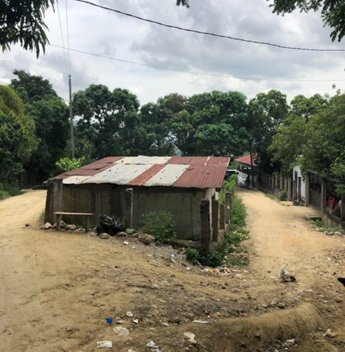
A home susceptible to flooding in San Pedro Sula, Honduras.
"El huracán Eta dejó de bastado todo Honduras," Sara's words from two years prior echoed in my mind as I walked through the barrios of San Pedro Sula, Honduras. The bright sun was a stark contrast with the flood-ravaged landscape I had imagined based on the stories I'd heard from immigrants who previously fled. While there wasn't active flooding during my visit, the impacts of Hurricanes Eta and Iota lingered in every Sampedrano's memory. Sara reflected on how the hurricanes tragically shaped her new life as an immigrant en route to the US, explaining that the hurricanes left all of Honduras destroyed. Sara, like many other immigrants I interviewed in Matamoros, Mexico, two years earlier, had lost everything to those floods.
Growing up in a family with immigrants, I was familiar with some of the challenges faced by those who leave their homes. However, listening to countless stories of loss and resilience made me realize that the relationship between hazards and human migration were even more complex than I’d imagined. My journey to my research began in the summer of 2021 in Matamoros, Mexico. There, my research lab and I interviewed immigrants across different shelters, each individual being brave enough to share their own harrowing story of displacement with us. The descriptions of the hurricanes they fled that ravaged Honduras painted a picture of a landscape I had yet to see with my own eyes. Little did I know that two years later, I would be walking those very streets they had described.
As a geographer studying human-environment interactions, I've come to realize that floods are not just natural disasters; they act as agents of entrapment and displacement, perpetuating cycles of vulnerability for those in precarious communities. My research focuses on these dynamics, examining how flood events influence human displacement and how recurrent floods in flood-vulnerable settlements create a persistent state of instability. Honduras lacks consistent and reliable climate data, making it difficult to understand where repeat floods occur and what the long-term impacts of these events are. I aim to contribute accessible and helpful data to help fill this gap.
As I interviewed dozens of immigrants in Matamoros, a pattern slowly emerged: floods were pushing people from rural areas into urban precarious settlements, only for them to face the same flood risks in their new homes. During my exploratory fieldwork in San Pedro Sula in the summer of 2023, the full weight of these narratives hit me. For one month, I got to experience firsthand the landscape I had only heard about through the stories of those who had fled. I spoke with a few residents about their experiences with Eta and Iota, and that's when something caught me by surprise.
As I was listening to a local Sampedrana reflect on her experiences with Eta and Iota, she mentioned a specific neighborhood park where the flooding had been particularly severe, trapping many people. A chill ran up my spine as I realized I had heard about this exact location before – from an immigrant I had interviewed in Matamoros two years prior, Sara. Sara and the current resident had experienced the same catastrophic floods, at the same park.
This moment of connection between two separate interviews, conducted years and countries apart, highlighted the sometimes arbitrary nature of who is able to leave and who isn’t, who becomes an immigrant and who remains to face recurring floods. The similarity of their stories, despite their vastly different current circumstances, underscored the profound impact that floods have on individual lives and entire communities.
To address the data gap that makes these stories so crucial, I'm employing a mixed-methods approach combining satellite imagery analysis with on-the-ground interviews. I examine satellite data to detect flood events, then ground these findings in community members' lived experiences. One of the most challenging aspects is making the data accessible and meaningful to those who need it most. I'm collaborating with local partners to co-create a flood database, helping communicate flood vulnerabilities to decision-makers and at-risk communities. For decision-makers, this information can guide more effective flood mitigation strategies and help create more resilient neighborhoods.
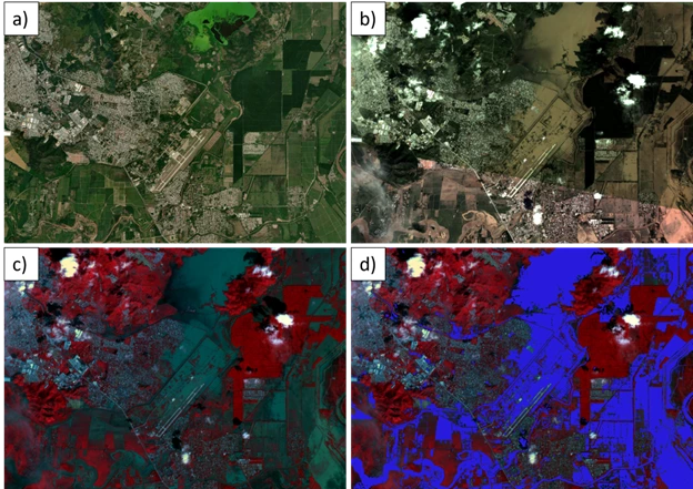
Example of detecting floods with satellite imagery: a) landscape under normal conditions, b) landscape post Hurricanes Eta and Iota, showing significant flooding, c) false-color imagery showcasing the floods of Eta and Iota, d) machine learning algorithm applied to satellite imagery to detect flood waters.
My hope is that this work will not only contribute to our scientific understanding of flood dynamics but also provide tangible tools for preparing communities for flood events. Understanding these complex human-environment relationships can help us better plan for current and future changes, improve flood mitigation strategies, and create useful climate information that supports communities living in precarious conditions.
This project is supported by the CLIMAS Environment & Society Fellowship program, the Arizona Institute for Resilience, and the Office for Research, Innovation, and Impact at the University of Arizona. Graduate fellows conduct collaborative and societally-informed research that addresses pressing environmental challenges around the world.